Expanding the knowledge base of Earth observation to reduce world hunger
How can Earth observation data be used in practice? This is what the EO CONNECT project aims to share with people around the globe. Satellite images can help us gain a better understanding of what is happening on our planet. Earth observation makes it possible to predict disasters, monitor our climate and even fight world hunger.
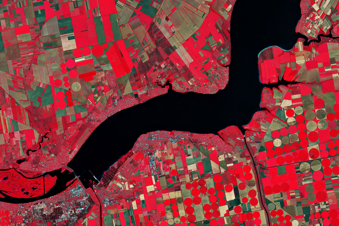
This false-colour image is a detail of a picture taken of southern Ukraine. The near-infrared channel that was included makes vegetation appear bright red. The image contains on modified 2019 Copernicus Sentinel data processed by ESA, CC BY-SA 3.0 IGO.
‘Zero Hunger’ is the second of the United Nations’ 12 Sustainable Development Goals (SDGs). All people should have access to safe and sufficient food. Earth observation technology can help achieve this goal. For example, satellite images can assess the vitality of crops on farmland on a large scale. This ensures the early detection of pest infestation or crop failure and enables farmers to take countermeasures.
But the vast range of use cases of Earth observation goes far beyond these examples. The many observation satellites that orbit the Earth today produce large quantities of data that is freely available. This data is used in agriculture and disaster management as well as for climate change monitoring. However, the skilled experts who know how to analyse and process this data are often lacking.
This is where the EO CONNECT project comes in: it is aimed at disseminating knowledge about using Earth observation data worldwide and at training as many people as possible.
Leveraging synergies through an online learning platform
Several Institutes of the Friedrich Schiller University Jena and RUB Ruhr-Universität Bochum have teamed up to make their existing Earth observation training resources available collectively and on an open-access online platform called EO College. This online learning platform offers courses, tutorials and learning materials under a free licence (CC BY SA). The institutes are planning a sweeping expansion of the range of resources on the platform together with other partners from their network.
The joint platform has synergistic effects as its infrastructure for metadata that scientists are creating makes it possible to use all materials in different contexts. Scientists are using gamification elements, collecting knowledge about new forms of online learning and sharing their experiences.
The extensive range of learning resources offered by EO College builds on a global network as the necessary satellite data is made available by space agencies DLR, ESA, NASA and JAXA. There are also plans for tailor-made courses to be developed and disseminated in close cooperation with UN organizations, i.e. FAO (the Food and Agriculture Organization of the United Nations) and UN-SPIDER (the United Nations Platform for Space-based Information for Disaster Management and Emergency Response), and with the World Bank.
What can Earth observation do?
Earth observation (EO), a term which is sometimes used interchangeably with remote sensing, is relevant for many areas. It describes the imaging of Earth’s surface and atmosphere. Images are taken based on the absorption of visible light (just like in normal photography) but also infrared radiation or radar. These images are then processed further to cater to specific (research) interests using automated digital image processing.
Earth observation data is essential for weather forecasting or climate monitoring. Time series with images taken at different points in time can be used to identify and document changes. Aerial images are particularly helpful in agriculture, forestry and regional planning. Different uses can be easily identified and classified. Earth observation is also very supportive in the areas of disaster management and the prediction of natural disasters. For example, Earth observation can register the rise and fall of Earth’s surface by only a few millimetres and thereby predict impending landslides or volcanic eruptions.
The Zero Hunger MOOC
The EO CONNECT project is also aimed at jointly developing a massive open online course (MOOC). MOOCs are open to anyone who is interested, without any participation requirements. The Zero Hunger MOOC will focus on the use of Earth observation to achieve the United Nations’ SDG 2 ‘Zero Hunger’. The various partners involved in the EO CONNECT network contribute to the course by providing, for example, educational videos, animations and interactive web tools. As the project scientists jointly develop this course, they acquire skills and knowledge they can use for their own follow-up courses.
The Zero Hunger MOOC will be available around the world, which means that the background of individual course participants will vary greatly. The goal is to empower people from emerging and developing countries in particular to use Earth observation data. This is why the course will have a modular structure, allowing participants to choose the entry point or thematic focus that best fits their needs.
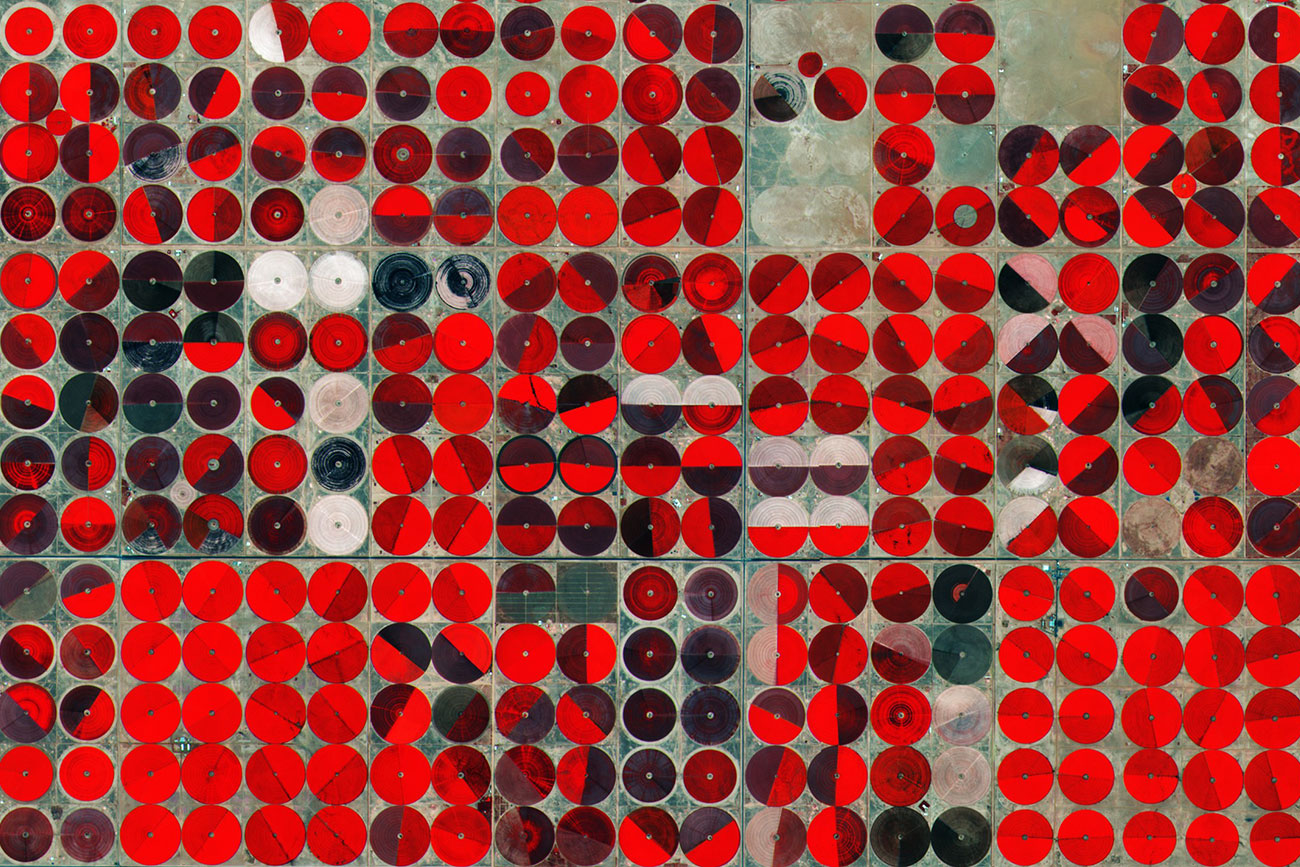
This false-colour image shows irrigated agricultural land in Saudi Arabia. The different shades of colour represent different crops and their vitality status. The image is based on 2015 Copernicus Sentinel data processed by ESA, CC BY-SA 3.0 IGO.
Making Earth observation knowledge available worldwide
The EO CONNECT project has come very close to achieving this aim thanks to its EO College learning platform!
The courses, tutorials and educational materials provided through this platform are largely in English. However, as they are provided under a free licence, they can be translated and made available in any other language. In this way, knowledge can be disseminated to many countries and at many levels.
Participants who have completed the online course will receive a course certificate, enabling them to provide evidence of their successful participation in the course and bring their new qualifications into practical application in their job.
While the contents of EO College focus on specific topics and are targeted at a global audience, the education initiative ‘Remote Sensing in Schools’ (FIS) is geared specifically towards school pupils and teachers. It was developed based on curriculum requirements of the German school system. Earth observation can be used in many school subjects such as geography, physics and computer science. Using satellite images for practical exercises in the classroom makes it easy to capture the imagination of adolescents and thereby recruit the next generation of Earth observation scientists.
We need your consent!
We want this website to meet your needs as best as possible. To this end, we use cookies and the web analytics tool Matomo to learn which pages are visited most often. Your visit is currently not being counted. By allowing us to count your visit anonymously, you help us to achieve this goal. Web analytics enable us to adapt this website to your needs. No data is forwarded to third parties. For further information, please see our privacy notice.